Study Guide to Case Study

Study Guide to the Johnstone River Case Study on Flooding
The steps you need to follow for a real river system in order make decisions about where and when it will flood and what you could do to minimise the destruction
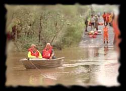
Coastal Queensland rivers can experience dramatic changes in levels
due to the torrential rain caused by cyclonic events.
Local goverments can act more effectively if they have a better idea of
the size and consequences of a particular flooding event.
This case study consists of selected material from a much more
comprehensive study by the Johnstone Shire.
It serves as an example of the steps needed to research, develop and
refine a response to flooding.
Step 1. Study of existing information and collect data
The Johnstone River Catchment contains the large North and South Johnstone Rivers, the Moresby River and Liverpool Creek which all drain some of the wettest terrain in Australia. Flood Risk is high. Previous Flooding is related to cyclonic rainfall. Flood Forecasting currently relies on the Johnstone River ALERT System while Flood Warnings and Bulletins are available through Telephone Weather Products. Flood Warnings and River Heights at various gauges along the drainages are currently used to give warning of floods. Moullyian gets a maximum of four hours notice and Innisfail a maximum of six hours notice but this assumes the flood can be detected and identified at the highest monitoring stations in the drainage and that the signal can be received on the coast.Assessment of the Flood Potential currently suggests that rainfall in excess of 200mm in 24 hours will lead to modrate flooding while rainfall in excess of 300mm will lead to major flooding. Flodd damage will be excessively greater if the flood peak corresponds to a king or high tide. Unfortunately the highest tides of the year occur during the cyclone season. A Background of the Johnstone River System is used to collect historical data and identify truble spots.
Step 2. Define Objectives
After consideration of existing data the Objectives of the Flood Study are formulated. This decision determines the Seven Key Stages in the Study .Step 3. Develop a computer flood model on which to design floods
You cannot wait for the actual floods in order to develop your strategies for daling with floods you must make a computer Flood Model then Compare the Model with Actual Rainfall at Innisfail from this you can generate Design Floods -Hypothetical Floods Used for Planning which must be verified by Calibrating the Flood Model example 1999 flood. Design Hydrology is the name given to the creation of artificial computer models that is properly created can mimic the actions of real potential flooding events. Two Methods are commonly used Method 1. Flood frequency analysis (FFA) estimates potential future floods on the basis of historical evidentce (like photos,and recorded river heights...) Method2. Design rainfalls with the URBS Model bases modelling on historic rainfall levels and intensities based on documentation provided by the Bureau of Meteriology http://www.bom.gov.au . A computer flood model is considered reasonable onl if there is General Agreement between the two Models and the results of model testing should largely agree with Historical Evidence of Flood Levels.Step 4. Design various benchmark floods and predict their impacts
Once the model is developed and calibrated it can be used to generate hypothetical floods. It is a Human Decision as to which heights constitute a flood . Again hisorical flooding patterns are researched to determine a Once in Two Year Flood , Once in Five Year Flood ,Once in Ten Year Flood , Once in Twenty Year Flood , Once in Fifty Year Flood , Once in One Hundred Year Flood and a Theoretical Maximum FloodStep 5. Insert various plans for reducing flood impacts into the flood design
From the design floods key areas that have a positive or negative impact on the rapid drainage of water from the area can be identified: digging out Carello's Channel would clear a bottleneck in the Johnstone River; Webb Levee protects the Central Business District; costly River Dredging may be paid for in part by selling the fertile silt for gardening; Carello's Levee is good for one residential area but not so good for another residential area compromise may be achieved by Modifying the Shape of Carello's Levee ; in flooding the recently raised Bruce Highway (the main north -south highway) facilitate vehicle movement but causes local flooding as it acts as a damLowering the Height of the Bruce Highway would reduce this flooding but could result in the highwy closing more often which would have an impact on many communities in the region; the town swamp , having been filled in over the years, has a reduced capacity to act as a holding area during flooding but his could be reversed by Removal of Fill from Town Swamp .Step 6. Estimate the cost of flooding to the region
Regional flooding comes at a great expense to everyone; The Effects of Flooding on the Local Economy include Rural Damages ,Urban Damages ,Infrastructure Damages ,Intangible Damages which when calculated can vield Summary Total Cost Including 1 in 100 year floods andSummary including possible maximum flood
Step 7. Make financial decisions on what you can afford
Unfortunately no Shire can afford all the possible actions that could be taken to minimise the impacts when good rivers turn bad. The must weigh The Benefits of the Construction of Flood Modification Measures against the Present worth of Annual Benefits by calculating The Present Worth Factor and working out Benefit-cost Ratios , to see which of the best flood mitigation techniques may be employed with the restraints of the annual budget.
Environmental Considerations must factor in to decisions as the area hosts a number of unique ecosystems due to its proximity to both rainforest and reef.
Step 8. Recognising the Risks and Informing the Public
Now that the risk and costs are understood we need to Choose Flood Hazard Categories and Initiate a Public Information Campaign on Flooding. Part of that campaign is this project!"