Tropical Cyclones
Tropical Cyclones
Tropical Cyclone Formation
Cyclone Stages
Cyclone Movement
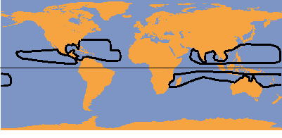
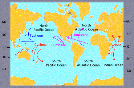
Hurricanes and Cyclones - major areas
affected
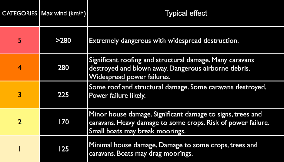
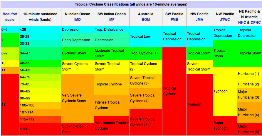
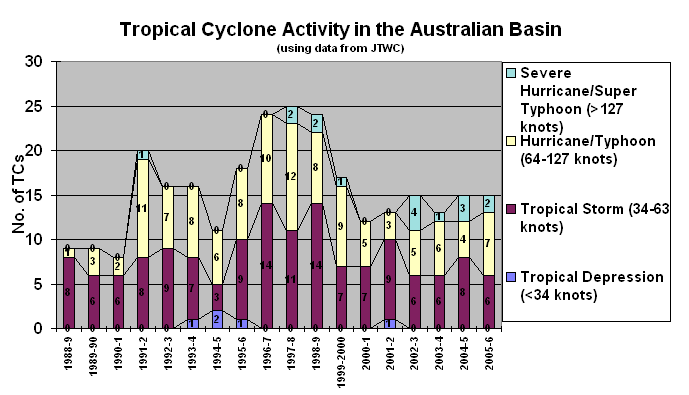
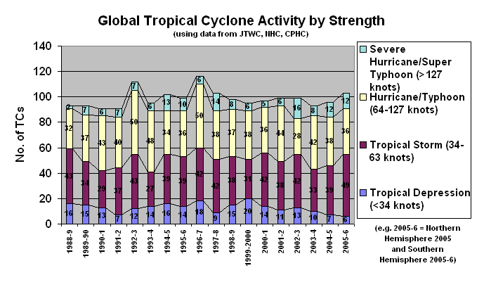
Cyclone Scales
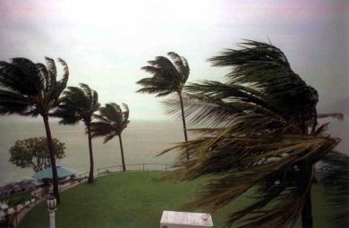
Cyclones over the warm tropical oceans are capable of producing dangerous winds, torrential rains and flooding,
all of which may result in tremendous property damage and loss of life in coastal populations.
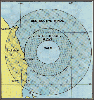
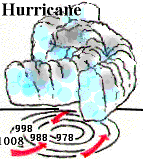
Cyclones rotate clockwise.
In the diagram shown above, on an east coast, the most rain and destructive winds would be on the southern edge of the cyclone.
In this example Innisfail is in the worst possible position with water laden winds accelerating over the hot ocean waters.
To the north the winds would be coming off the land, be weaker and drier.
In order to make your escape plans you need to know which edge of the hurricane or cyclone is about to affect you.
In the example shown residents should evacuate at least as far north as Cairns.
Innisfail was hit with a Category 5 Cyclone with winds over 200kmh. Many homes severely damaged, power was out for 3 weeks.
Cairns had little rain and a few wind gusts to 75kmh
Tropical Cyclones - Southern Hemisphere - rotate due to the coriolis effect in a clockwise direction
Hurricanes - Northern Hemisphere - rotate due to the coriolis effect in an anti- clockwise direction
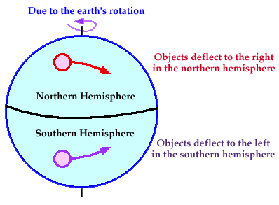
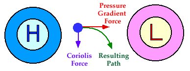
Tropical cyclones
- have winds that exceed 34 knots (39 mi/hr)
- blow clockwise in the Southern Hemisphere and
- counter-clockwise about their centers in the Northern Hemisphere
Formation
Cyclones are formed from simple thunderstorms. However, these thunderstorms can only grow to cyclone strength with cooperation from both the ocean and the atmosphere. First of all, the ocean water itself must be warmer than 26.5 degrees Celsius (81°F). The heat and moisture from this warm water is ultimately the source of energy for cyclones. Cyclones will weaken rapidly when they travel over land or colder ocean waters -- locations where their heat and/or moisture sources do not exist.
Related to having warm ocean water, high relative humidities in the lower and middle troposphere are also required for cyclone development. These high humidities reduce the amount of evaporation in clouds and maximizes the latent heat released because there is more precipitation.
The vertical wind shear in a tropical cyclone's environment is also important. Wind shear is defined as the amount of change in the wind's direction or speed with increasing altitude.
When the wind shear is weak, the storms that are part of the cyclone grow vertically, and the latent heat from condensation is released into the air directly above the storm, aiding in development. When there is stronger wind shear, this means that the storms become more slanted and the latent heat release is dispersed over a much larger area.
Stages of Development
Stages of Development from tropical depression to cyclone
Cyclones evolve through a life cycle of stages from birth to death. A tropical disturbance in time can grow to a more intense stage by attaining a specified sustained wind speed.
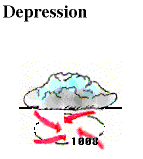
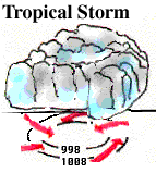
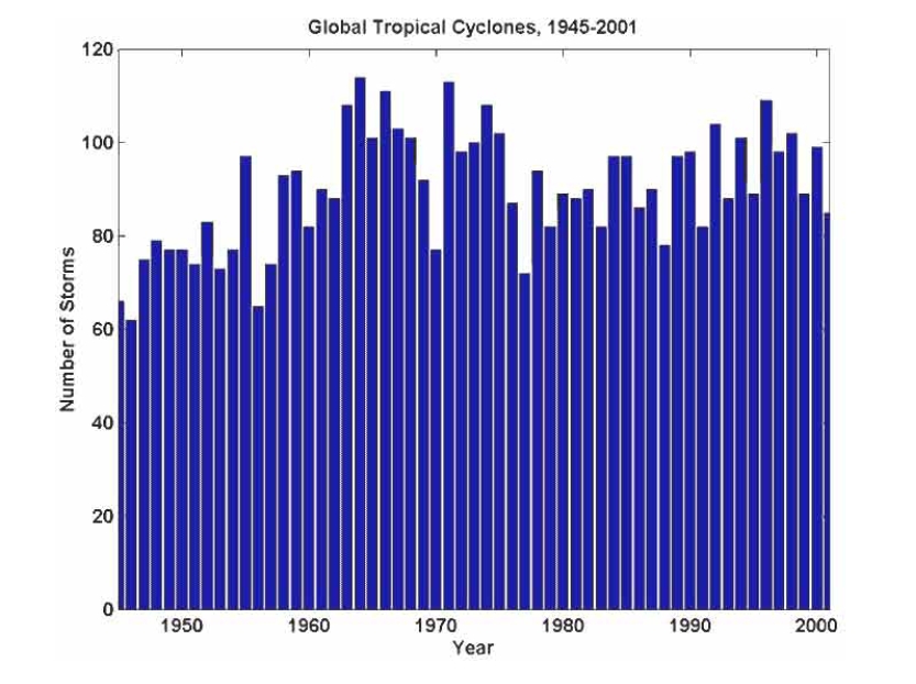
Cyclones can often live for a long period of time -- as much as two to three weeks. They may initiate as a cluster of thunderstorms over the tropical ocean waters. Once a disturbance has become a tropical depression, the amount of time it takes to achieve the next stage, tropical storm, can take as little as half a day up to a couple of days. It may not happen at all. The same may occur for the amount of time a tropical storm needs to intensify into a cyclone. Atmospheric and oceanic conditions play the major role in determining these events.
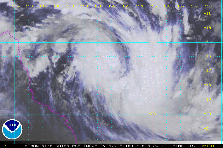
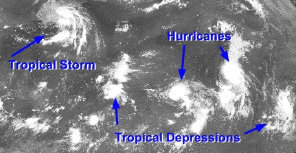
Below, in this satellite image from 1995, we can see different tropical disturbances in each stage are evident. At the far left, Tropical storm Jerry is over Florida, while Hurricanes Iris and Humberto are further east, amongst a couple of tropical depressions.
Movement of Cyclones
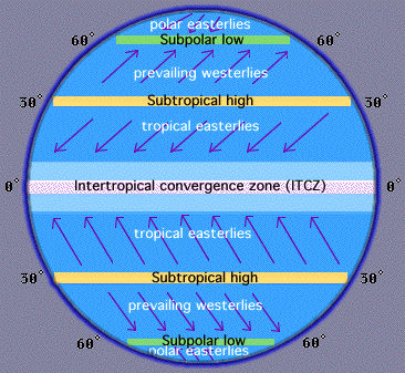
Movement of Cyclones steered by the global winds
The global wind pattern is also known as the "general circulation" and the surface winds of each hemisphere are divided into three wind belts:
Polar Easterlies: From 60-90 degrees latitude.
Prevailing Westerlies: From 30-60 degrees latitude (aka Westerlies).
Tropical Easterlies: From 0-30 degrees latitude (aka Trade Winds).
The easterly trade winds of both hemispheres converge at an area near the equator called the "Intertropical Convergence Zone (ITCZ)", producing a narrow band of clouds and thunderstorms that encircle portions of the globe.
The path of a cyclone greatly depends upon the wind belt in which it is located. A cyclone originating in the eastern tropical Pacific, for example, is driven westward by easterly trade winds in the tropics.
Eventually, these storms turn northwestward around the subtropical high and migrate into higher latitudes.
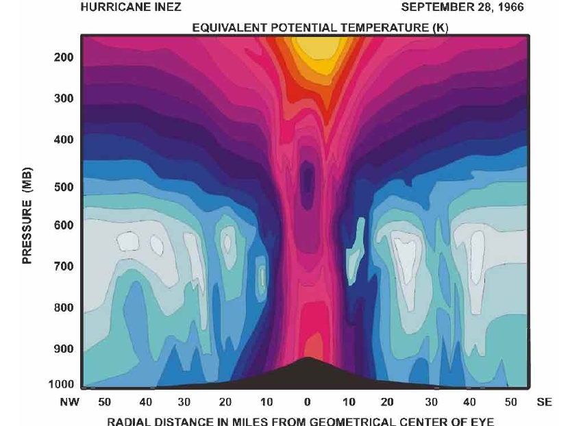
Plan , Section and Side Views of a Hurricane
In time, cyclones move into the middle latitudes and are driven northeastward by the westerlies, occasionally merging with midlatitude frontal systems.
Cyclones draw their energy from the warm surface water of the tropics and latent heat of condensation, which explains why cyclones dissipate rapidly once they move over cold water
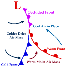
Occluded Front when a cold front overtakes a warm front
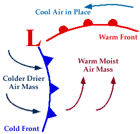
A developing cyclone typically has a preceding warm front (the leading edge of a warm moist air mass) and a faster moving cold front (the leading edge of a colder drier air mass wrapping around the storm). North of the warm front is a mass of cooler air that was in place before the storm even entered the region.
As the storm intensifies, the cold front rotates around the storm and catches the warm front. This forms an occluded front, which is the boundary that separates the new cold air mass (to the west) from the older cool air mass already in place north of the warm front. Symbolically, an occluded front is represented by a solid line with alternating triangles and circles pointing the direction the front is moving.
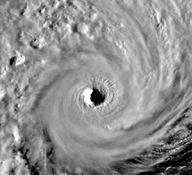
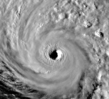
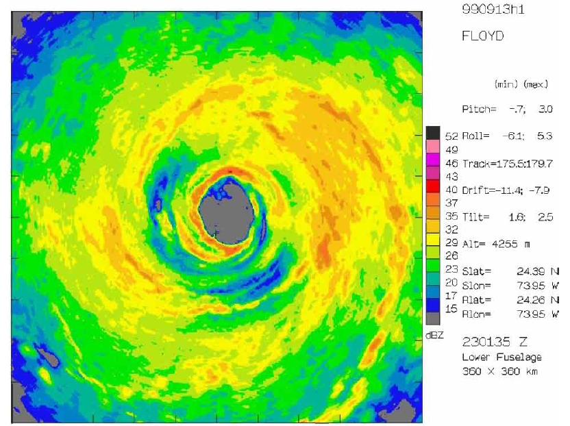
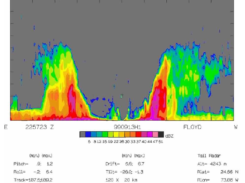
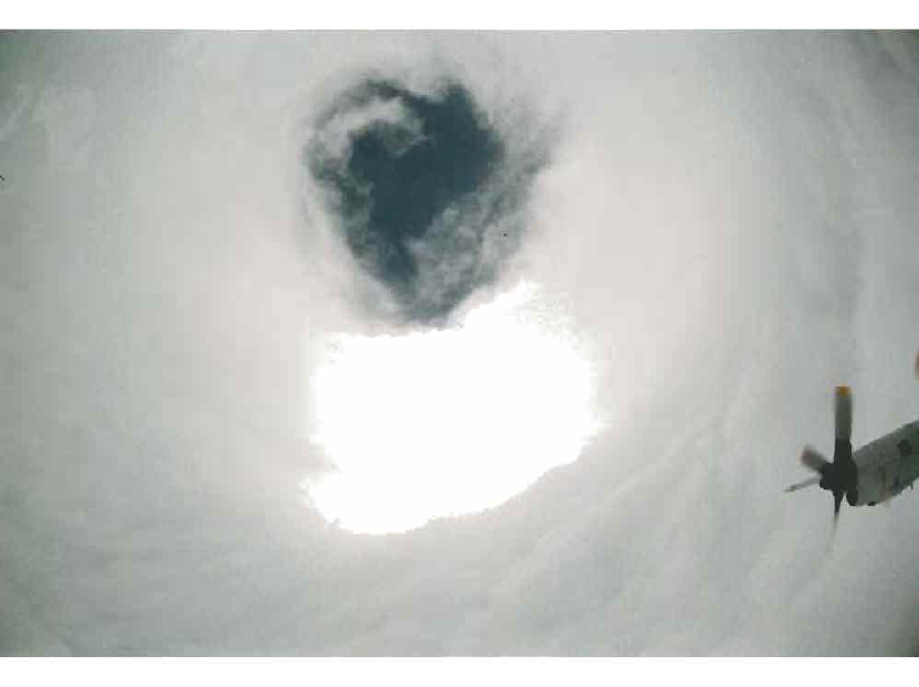
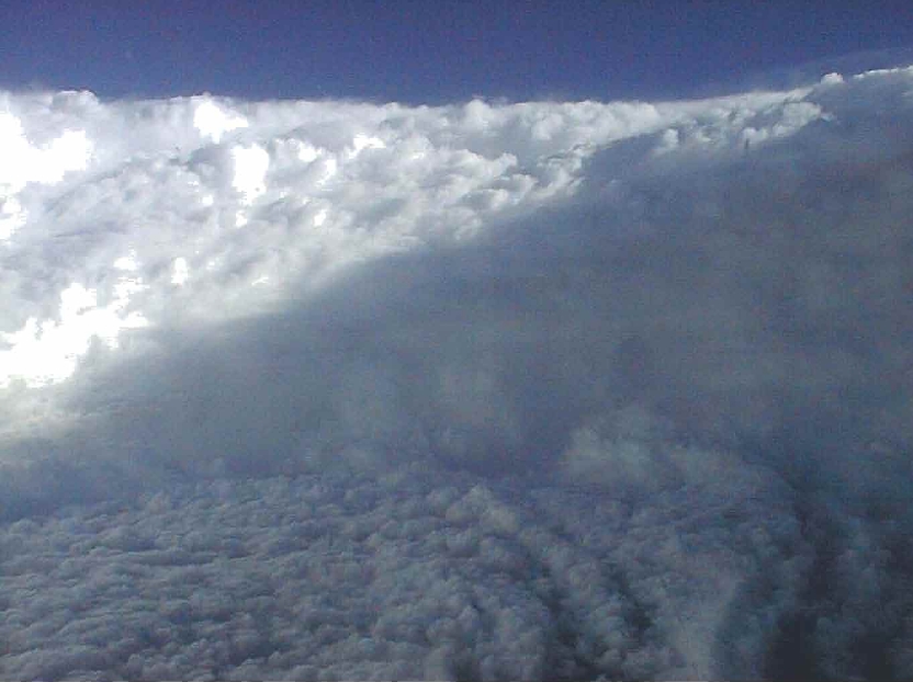
Two Views of the Eye of a Cyclone
Hurricanes and Cyclones - major areas affected
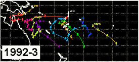
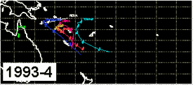
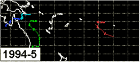
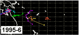
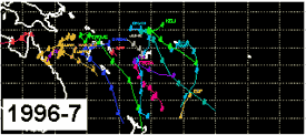
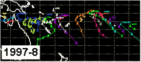
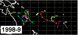
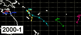
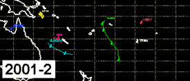
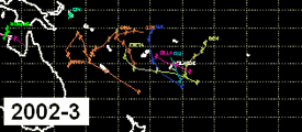
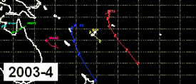
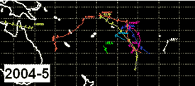
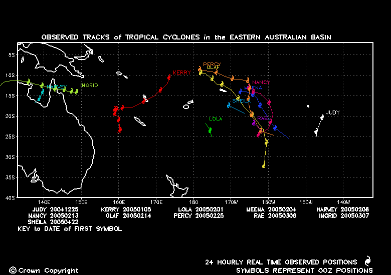
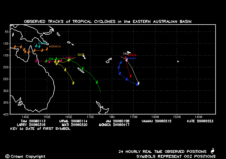
Cyclone Tracks by Year Eastern Australian Coast
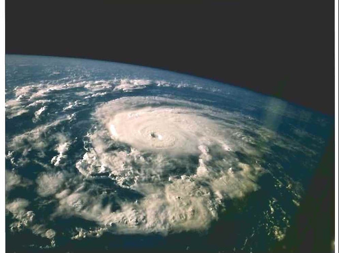
View of Hurricane from Space
Cyclone Scales